The first installation of a TYDAC WebGIS at the city of St. Gallen was in 1997! In spring 2019, the aging Neapoljs application (in use since 2003) was replaced by MAP+.
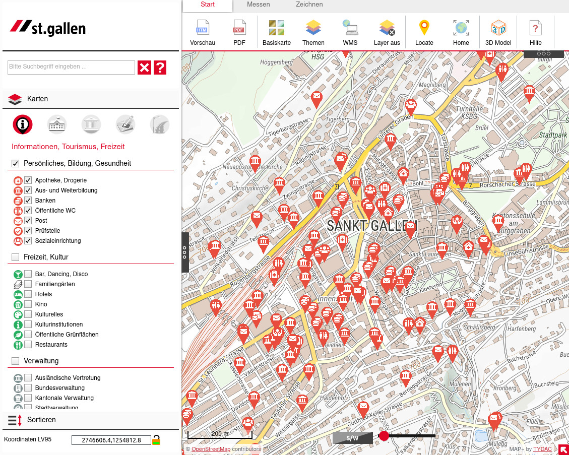
The result is a city map site based on the latest MAP+ version, with UMN MapServer as the web mapping server. A few key figures:
Four base maps: base map, official cadastral survey, aerial photo 2018 and OSM++ Switzerland
A total of about 175 layers in 15 categories (plus many more on the intranet). Easy and fast to find thanks to the unique layer control and search function of MAP+.
Preconfigured themes
Search with Apache Lucene Solr, the blazing-fast, open source enterprise search platform: extremely fast and intuitive search for objects and maps
Light and Embedded Versions for integration into web pages
Integration of Infra3D from iNovitas (Intranet)
Link to 3D city map
Version for smartphones
We may quote Mr. Stephan Horat, Head of Geomatics and Surveying and City Surveyor:
The new city map is a joy to use - we appreciate the speed and especially the flexibility and openness of the configuration: almost anything is feasible. Also very important to us are the options for connecting data and services from all conceivable sources - primarily our own data, but also federal and cantonal data services, as well as services from TYDAC.