MAP+

MAP+

MAP+ goes far beyond what is expected under the term WebGIS. Conventional WebGIS allow to view and print geodata. MAP+ offers much more:

  • Freely configurable user interface (see slideshow above)
  • Easy-to-use web-based user management that supports clients, portals, profiles and groups. This allows individually tailored applications to be configured. With Geozug Geodatenonline, municipalities, plants, engineering offices, etc. can access 25 different applications with about 200 user groups.
  • Capture, Edit:
    • Capture points, lines and areas, also combined in the same layer
    • Island polygons, multipolygons
    • Snap functionality
    • Overlays with existing objects
    • Attribute entry using forms
    • Capture via photo upload
    • Responsive capture capabilities using a smartphone
  • Modules
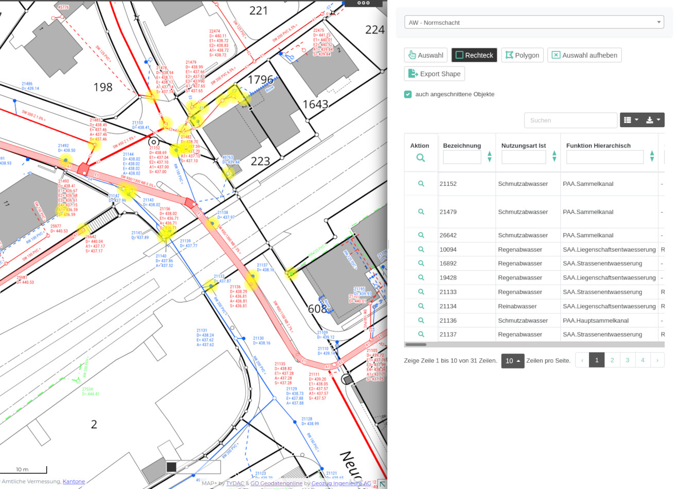
    • Lists from database tables, combined with the possibility of geographical selections. Data export of entire tables or selections to shape, xls, csv, json etc.
    • Nested forms with options for data entry via linked tables, data upload of documents, videos, etc.
    • PDF reports with map integration and possibility of geographic analyses such as any overlays. Examples: signalization, tree cadastre, channel management

Lists: search, queries, data export

This allows database tables and joins to be published as lists. The functionality includes:

  • Filter by database content
  • Smart boolean filter with three states: no filter, true, false
  • Search function over all fields
  • Geographical selection: selection (toggle on/off), rectangle, polygon. In addition, toggle on or off the option "only trimmed objects"
  • Arbitrary combination of filters and geographical selection
  • Export function: ESRI Shape, JSON, XML, CSV, TXT, SQL, MS Excel
  • Selection of fields to be displayed

The configuration of the lists is done in Json files and is as easy as it can get ...

Example:

Forms

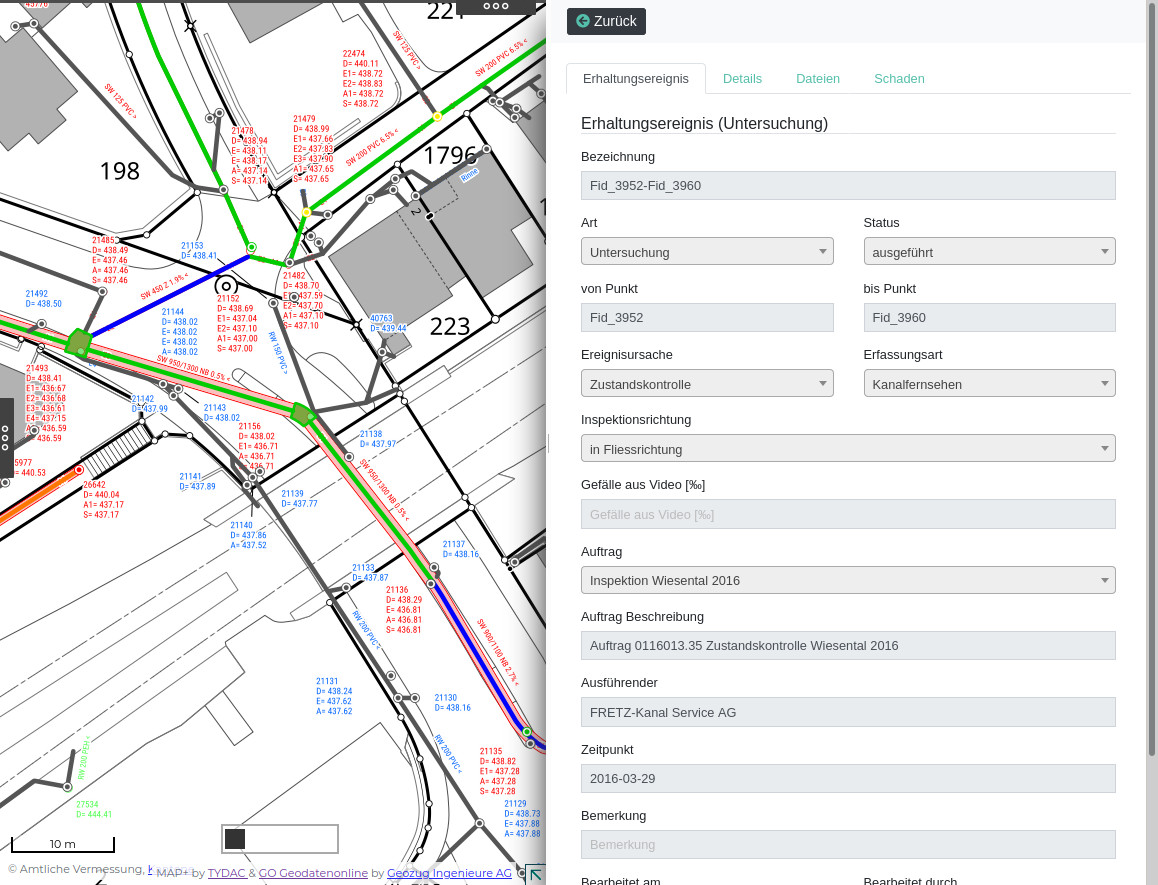
The sewer management system KMS of Geozug Geodatenonline consists of a larger number of complex, editable forms:

  • Measures: Preservation event, associated files (documents, images, videos), damage (videos), see example below.
  • Investigations: Preservation event, details, files, damage.
  • Cleaning

Part of the system is also a synchronization of the data edited in PostGIS with the main database on SQL Server.

Example measures:

bingo

Successfully complete registration